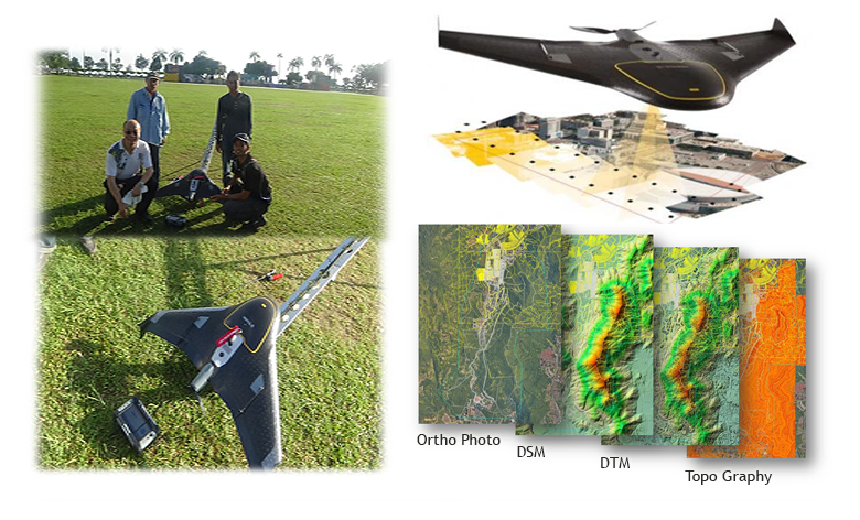
Aerial Mapping is a mapping method using UAV survey done by using UAV aircraft / propeller. We provides an intuitive workflow that allows you to quickly create orthomosaics and 3D models (DSM or DTM) for many applications such as large open area of survey in a shorter time when compared to conventional ground survey.
Its Application include:
- Agriculture Solution( provide Infrared image )
- Asset Mapping
- Construction Progress Photography
- DSM for Profile & Volume
- Disaster Management
- Design for Town/Development Planning
- Map Updating
- Mining (open area)
- Route Selection